Once a sandy hinterland, the city's western edge has seen its fair share of changes over the last century.
With help from SFMTA's Historical Photo Archive, today we bring you a look at how the Outer Sunset's streets and unpaved roads once looked, compared with pictures of the same locations today.
How much has changed, and what's stayed the same? Take a look:
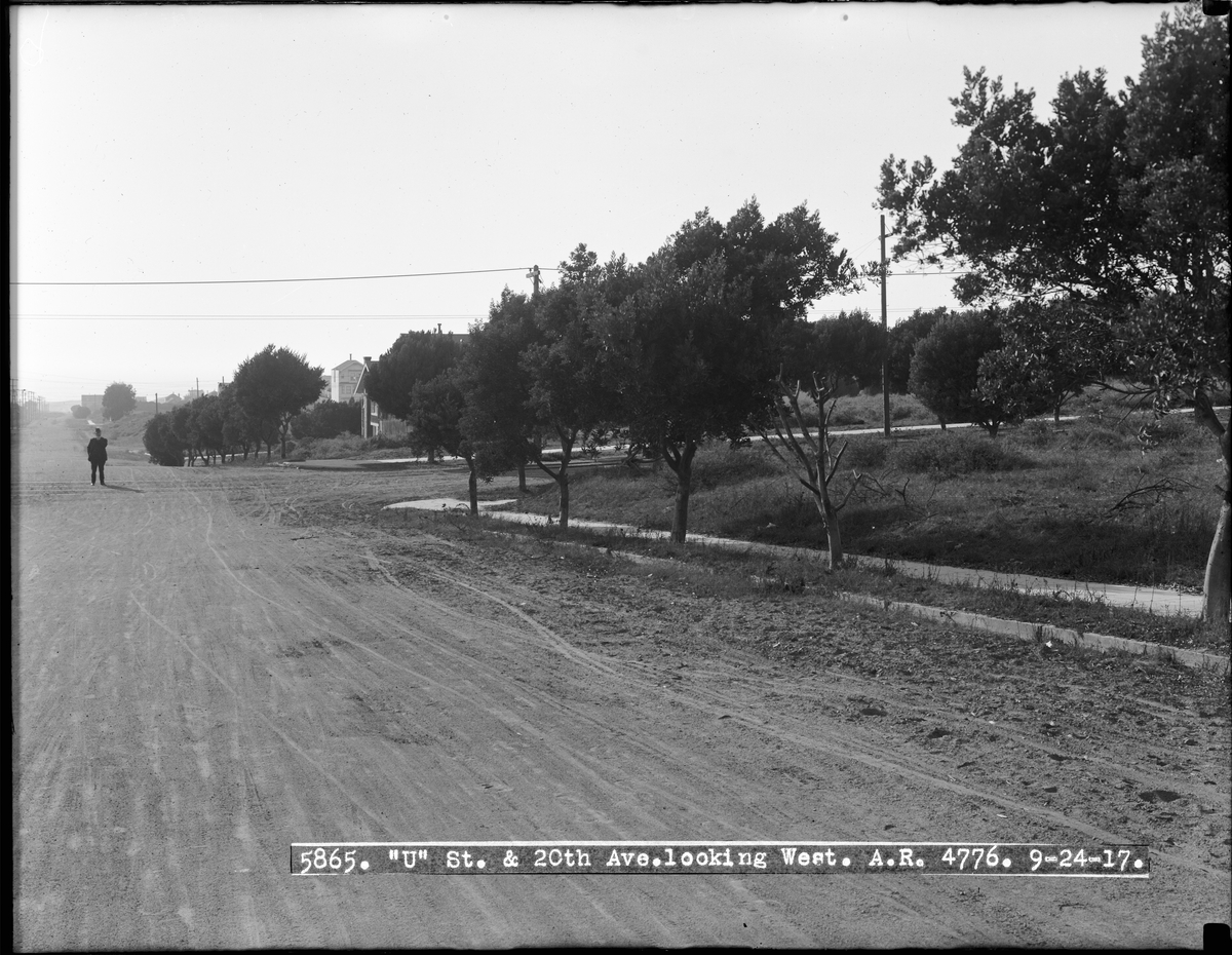
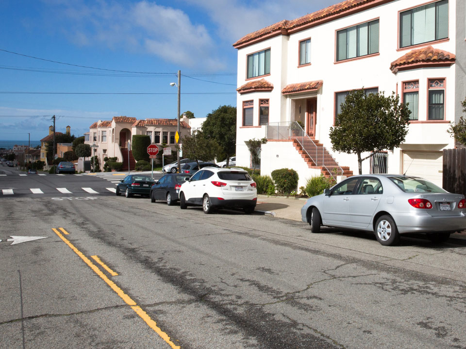
20th Avenue and Ulloa Street Looking West
September 24, 1917
February, 2016:
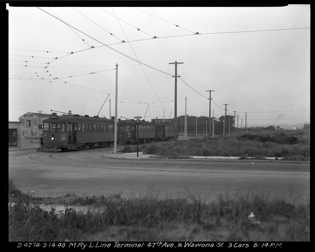
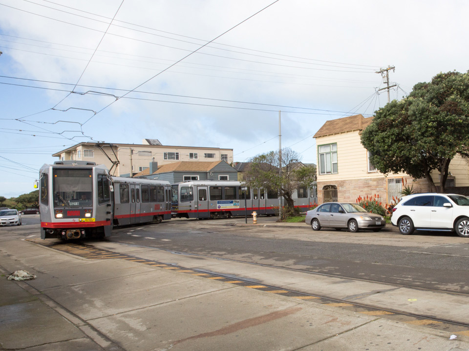
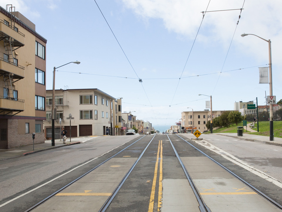
Streetcars at L Line Terminal on 47th Avenue and Wawona Street
March 14, 1940:
February, 2016:
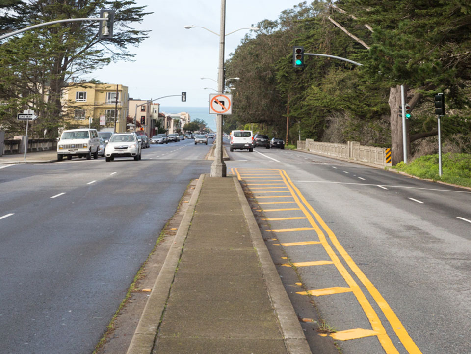
Lincoln Way and 44th Avenue Looking West Towards Ship on Pacific Ocean
January 2, 1919:
February, 2016:
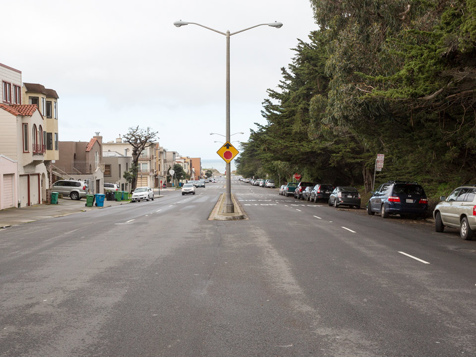
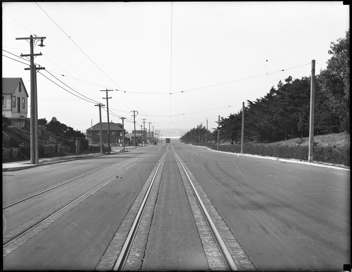
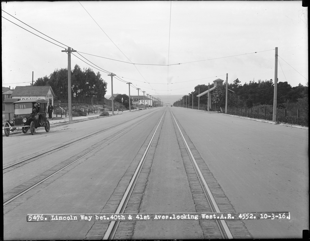
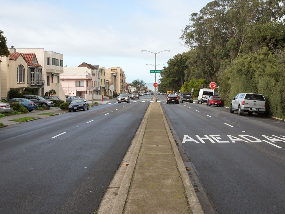
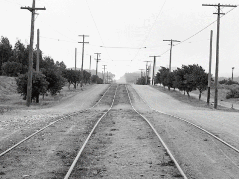
Lincoln Way Between 40th Avenue and 41st Avenue Looking West
October 3, 1916:
February, 2016:
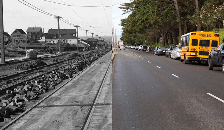
Raising Streetcar Tracks on H Street (aka Lincoln Way)
June 28, 1909:
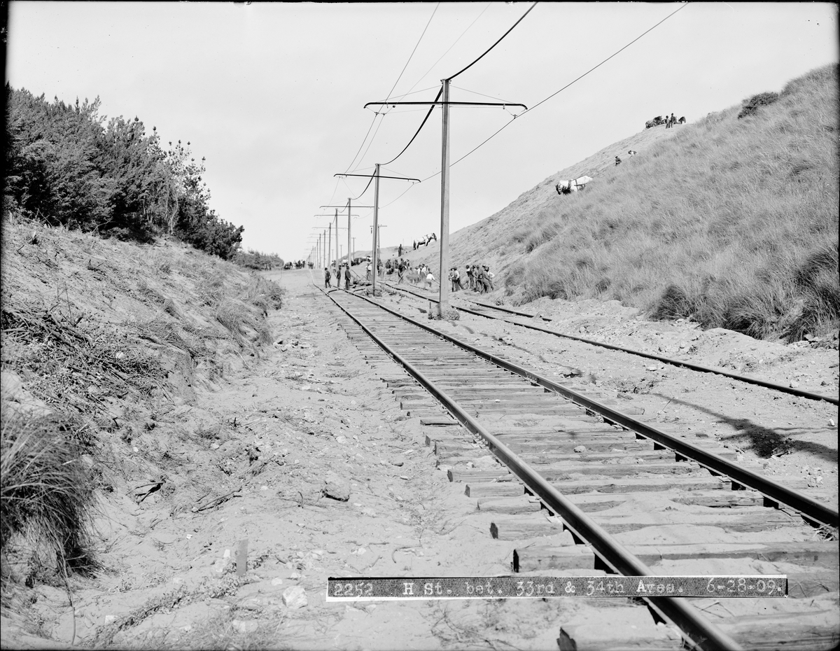
February, 2016: (Note: a commenter points out that this photo is likely taken from the opposite direction)
Streetcar Track Construction at Lincoln Way and 37th Avenue Looking East
December 1, 1931:
February, 2016:
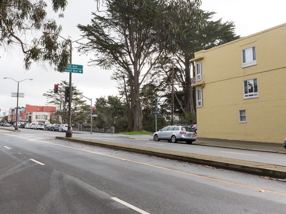
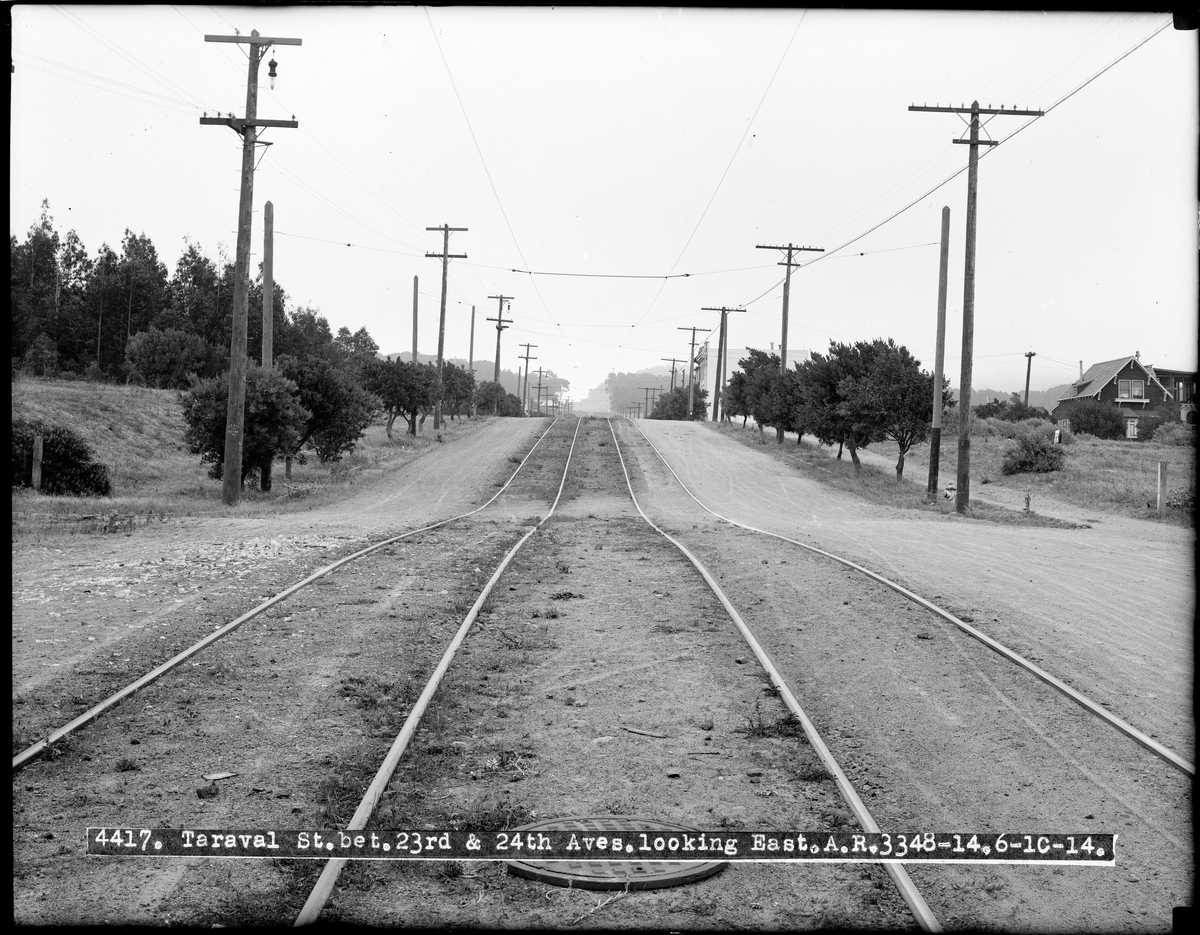
Taraval Street and 23rd Avenue Looking East
June 10, 1914:
February, 2016:
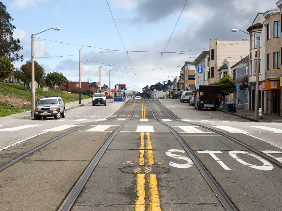
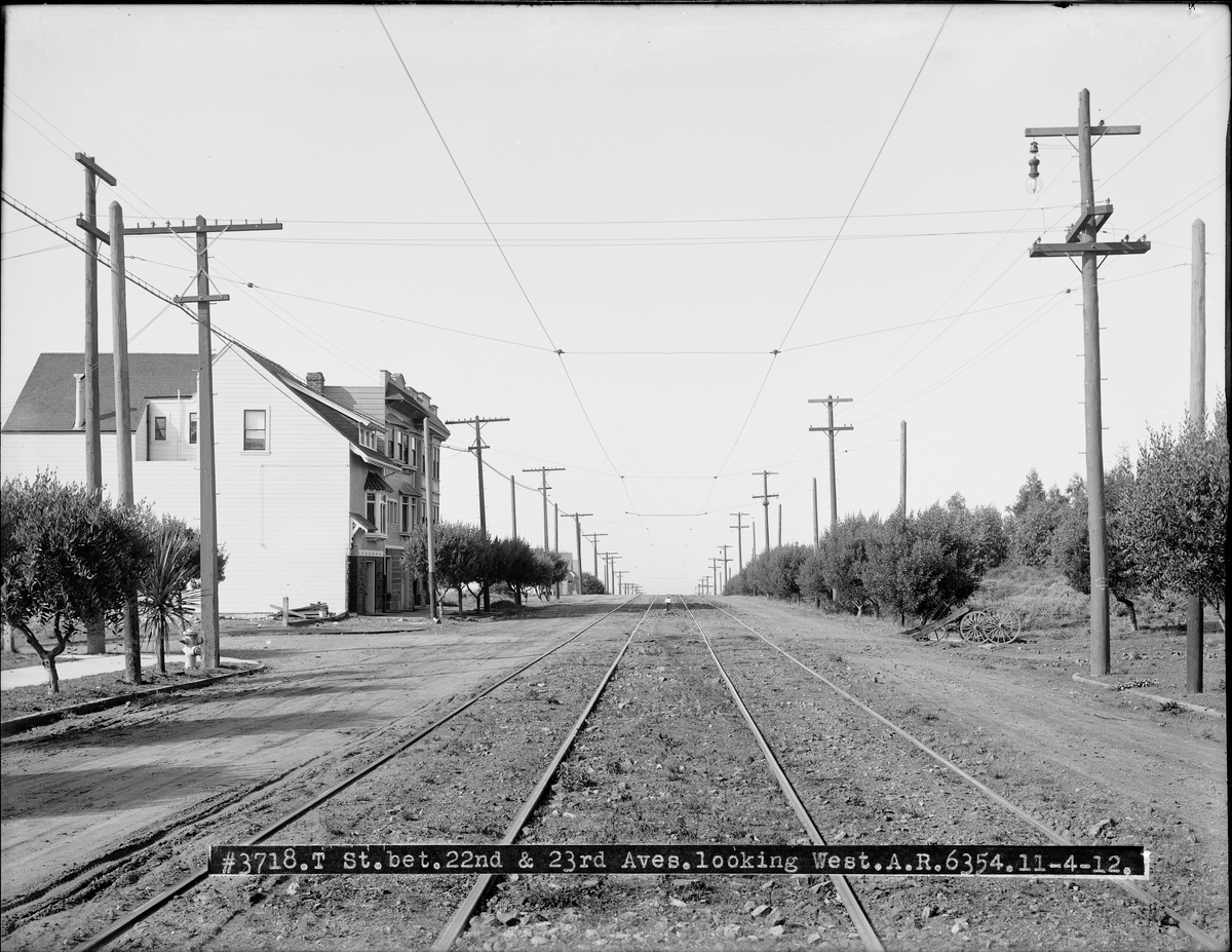
Taraval Street and 22nd Avenue Looking West
November 4, 1912
February, 2016:
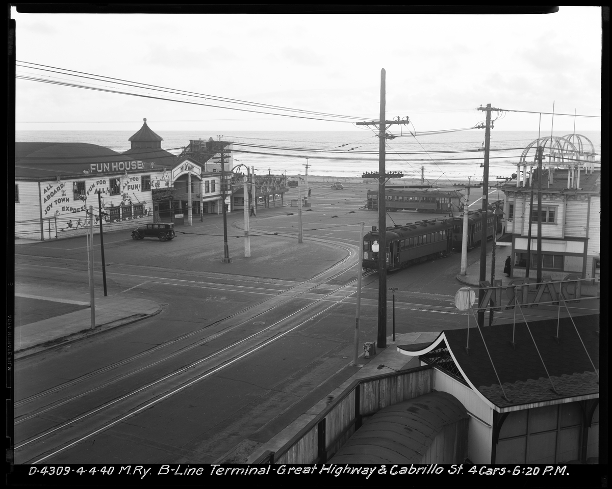
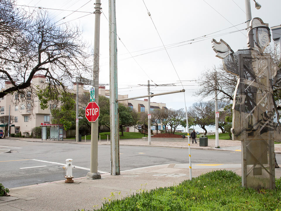
B Line Terminal at Cabrillo Street and Great Highway
April 4, 1940:
February, 2016:
Lincoln Way Between 35th Avenue and 36th Avenue Looking West
November 14, 1918
February, 2016:
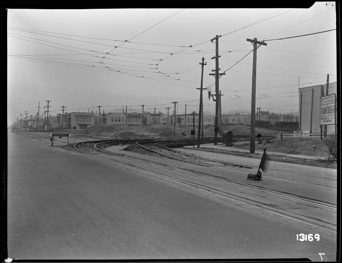
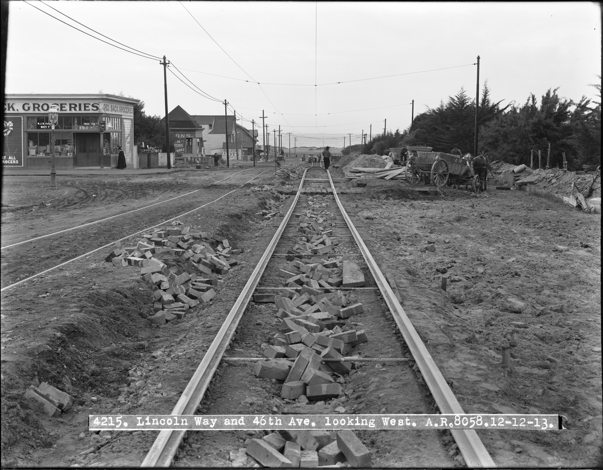
Construction on Streetcar Tracks at Lincoln Way and 46th Avenue Looking West
December 12, 1913:
February, 2016:
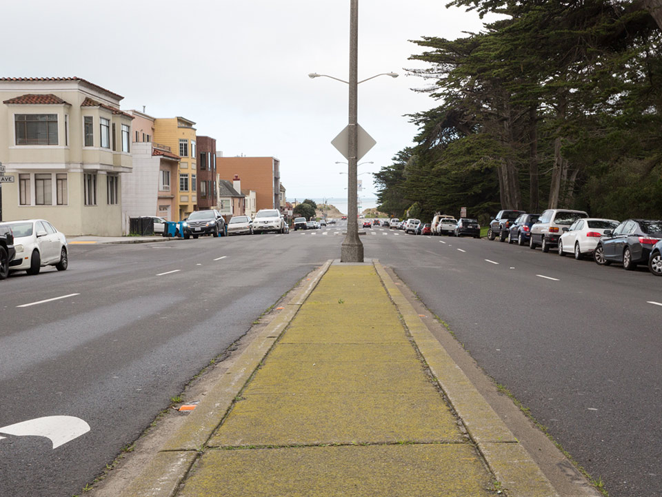
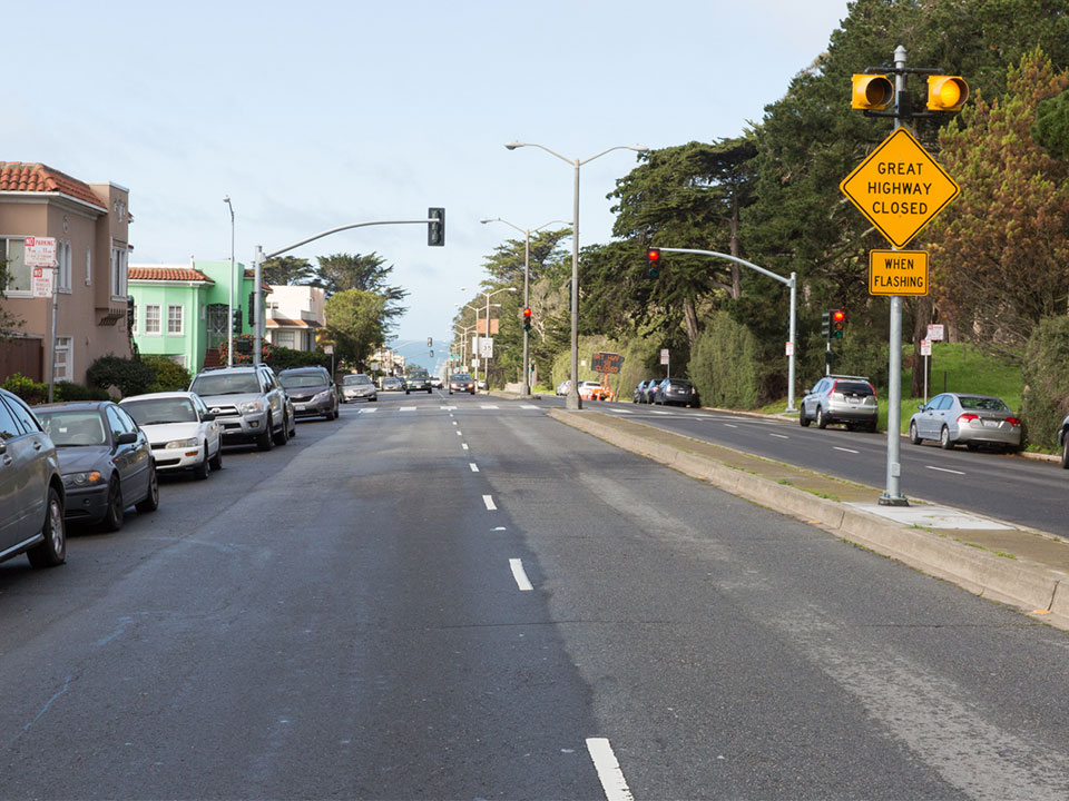
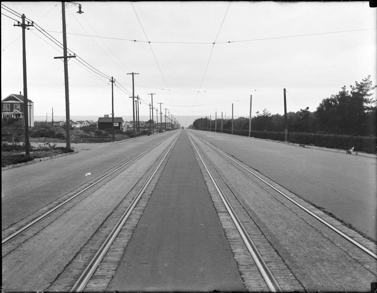
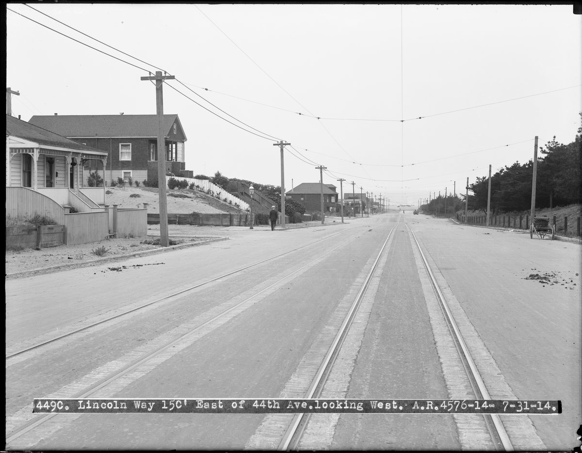
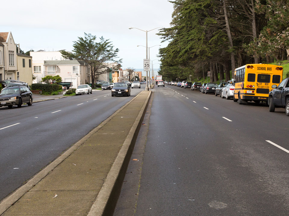
Lincoln Way East of 44th Avenue Looking West
July 31, 1914:
February, 2016:
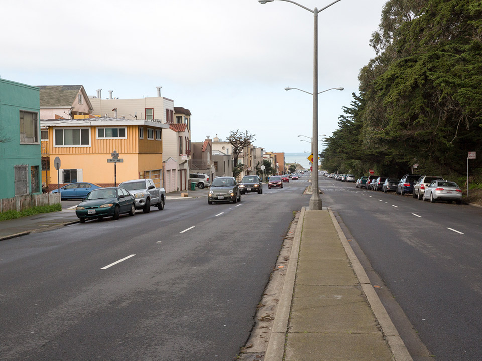
Lincoln Way Looking West from 42nd Avenue
January 8, 1914
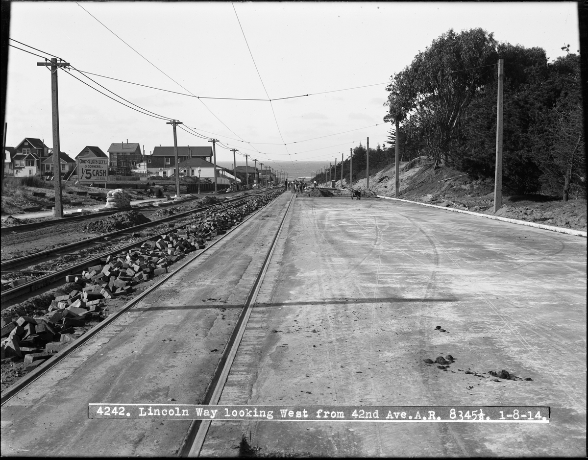
February, 2016:
And finally, here's an animated look at the difference between the Taraval & 23rd of 1914 and today:
Previously: Then And Now: Lincoln Way In Photos


