After a foggy start, expect a return to sunny skies with temperatures climbing into the high 80s today. The lift in fog should come by late morning paving the way for a warm, sunny afternoon with light to moderate winds, according to National Weather Service forecasts.
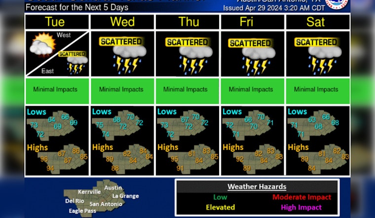
Areas of fog, some dense this morning and chances of showers and storms Tuesday through Saturday. Otherwise, seasonally warm and humid conditions are expected through next weekend. pic.twitter.com/x7saQ0JW9d
— NWS Austin/San Antonio (@NWSSanAntonio) April 29, 2024
However, don't let the pleasant conditions fool you. Isolated storms may touch down on the city's eastern fringes by evening, though significant severe weather isn't on the radar just yet. The calm before the storm is but a prelude to the "strong storms" expected to hit mid- to late week, poised to usher in May with a thunderous entrance, as per KXAN.
Tuesday's going to look much the same – morning clouds giving way to sunshine and sticky heat. The real action starts Wednesday when chances for showers and thunderstorms jump to 40 percent, ratcheting up the weather's unpredictability. The Southeast wind will pick up as well, blowing with gusts that could hit 25 mph, as reported by the National Weather Service.
Residents should brace themselves, particularly on Thursday when the threat of flash flooding peaks. Austin sits squarely in a level 2 out of 4 risk zone for flash flooding, a cautionary note issued by the Weather Prediction Center. "Our highest threat for flash flooding comes on Thursday," as detailed by KXAN.


