Lake Merced has drawn humans and wildlife to its shores for centuries, initially as a brackish lagoon and more recently as a coastal freshwater lake. It has endured a variety of challenges, but today the heart-shaped park in the southwest corner of the city breathes life into our metropolis as a significant natural habitat and recreation area.
Designated as a park in 1950, the lake's upland areas and four interconnected ventricles—North Lake, East Lake, South Lake and Impound Lake—are owned by the San Francisco Public Utilities Commission, and the San Francisco Recreation and Parks Department manages the recreation and natural resources. Over 600 acres of water and land are open to the public for walking, jogging, bicycling, boating, birdwatching, fishing, picnicking and dog walking.
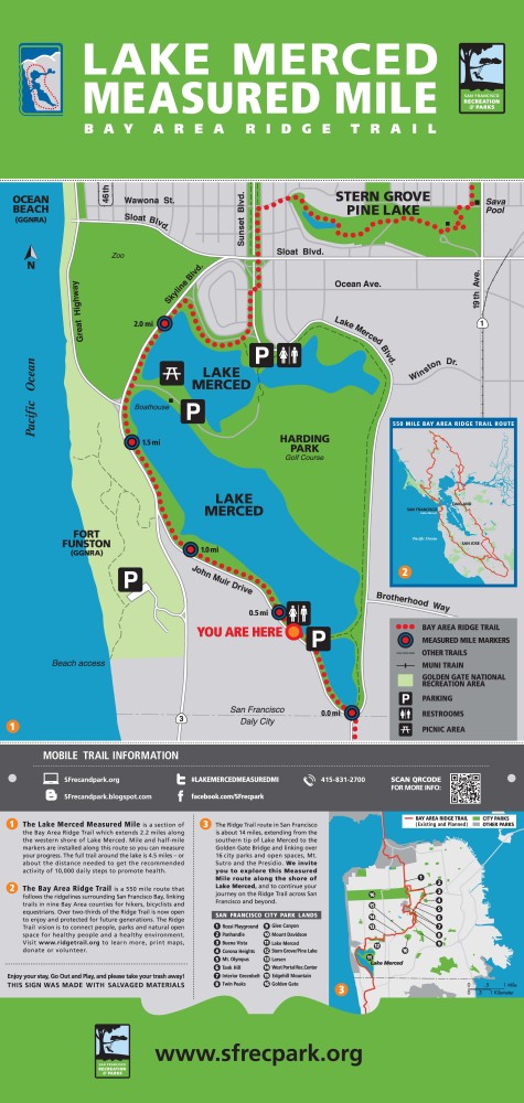
The park is bounded by Lake Merced Boulevard to the north and east, John Muir Drive to the south and Skyline Boulevard to the west. Harding Park, a 72-hole Tournament Players Club municipal golf course sits in the middle. A paved 4.5-mile multi-use trail popular with walkers and joggers circumnavigates the park next to the busy perimeter roads, with the western side of the loop trail identified as part of the regional San Francisco Bay Area Ridge Trail.
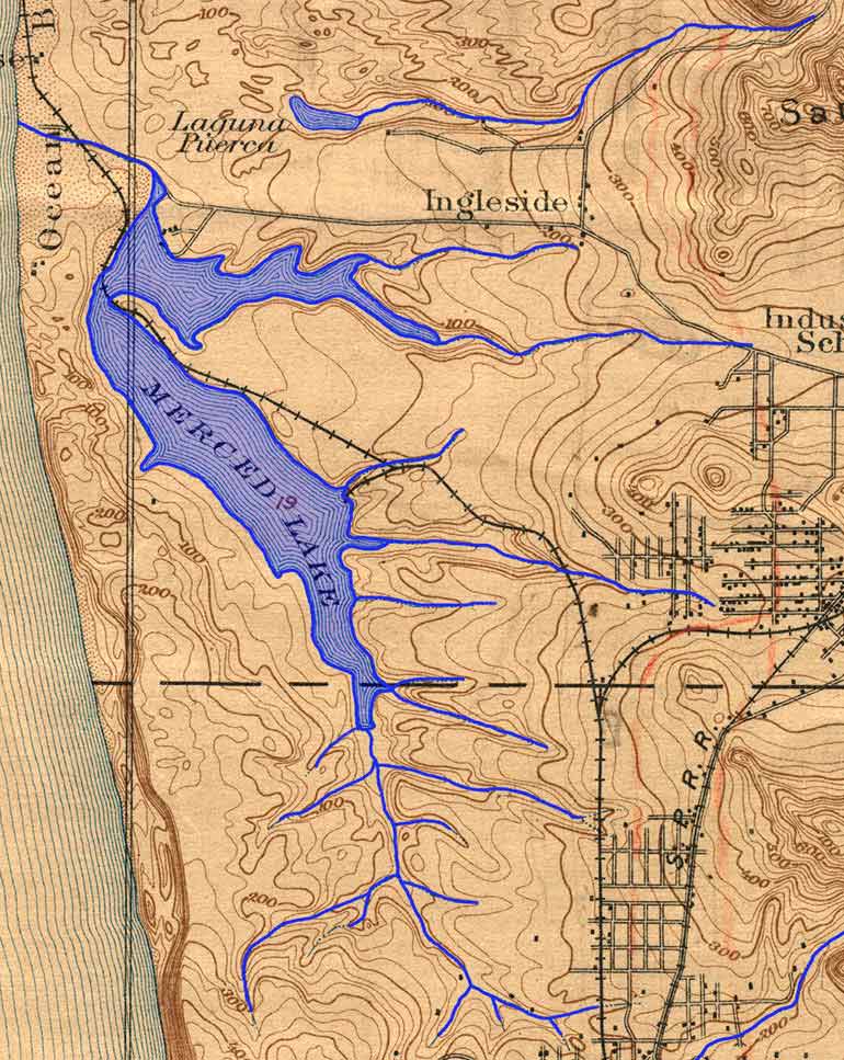
Historically, the waters of Lake Merced had tidal connection to the Pacific Ocean, but shifting sand dunes eventually formed a barrier separating the lake from the sea, creating a freshwater lake. The lake is fed by rainfall and an underground aquifer that also supports Pine Lake to the north. Lake Merced supplied drinking water to the city beginning in the late 1860s until 1934, when the Hetch Hetchy reservoir in the Sierras replaced it as the water source. Lake Merced now serves as an emergency source of non-potable water for residents.
Lake Merced and its watershed have experienced significant changes through the ages, as shown in this Found SF series of historical photos.
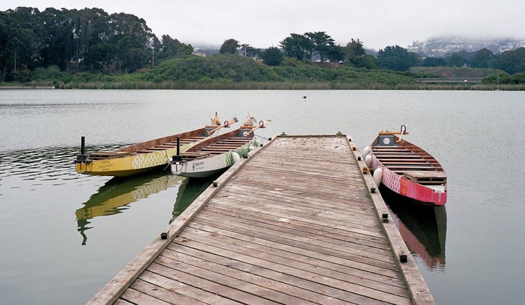
A good place to begin exploring Lake Merced Park is the Harding Park entrance off Skyline Boulevard, along a land bridge that separates North Lake from South Lake. Muni's 57-Parkmerced bus stops here and there is a large parking lot, public restrooms and drinking fountains. Picnic tables, grills, lawns and docks make this a popular gathering place for families.
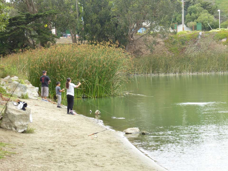
You can get close to and on the water here. Venture down to North Lake’s beaches and piers for a chance to catch rainbow trout. (A fishing license is required for anglers 16 and older.) The California Department of Fish & Wildlife stocks North Lake with fish in winter and spring. On the South Lake side, the Lake Merced Boathouse supports boating activities and docks for the Pacific Rowing Club. The renovated clubhouse has an exercise area, boat storage and a community room.
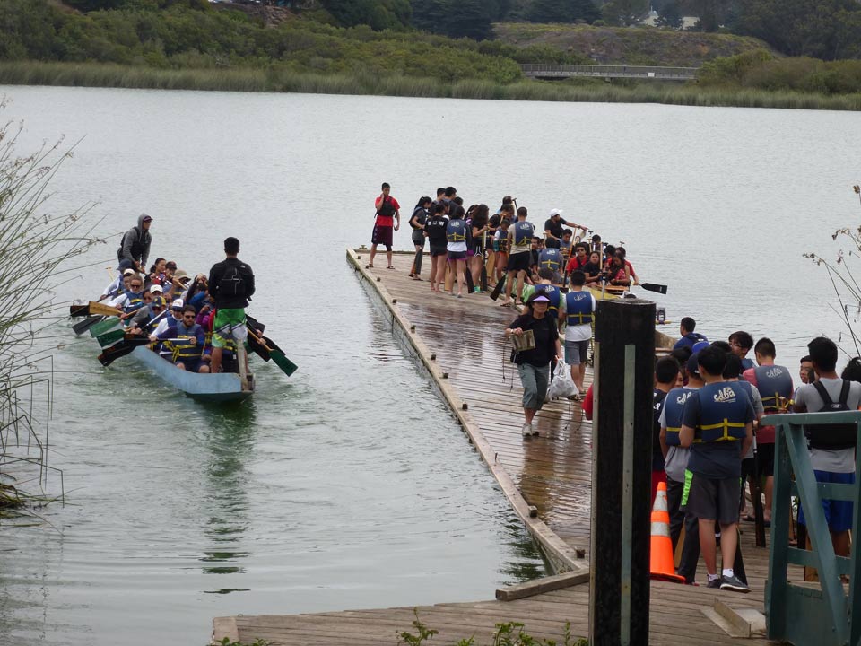
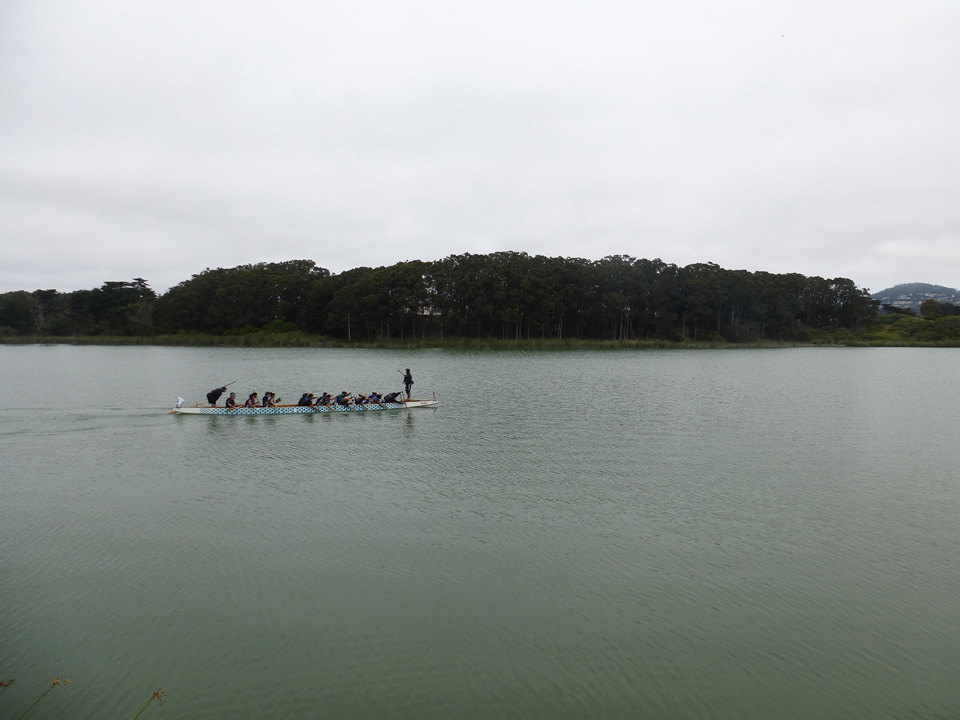
Early on a recent weekend morning, paddlers with the California Dragon Boat Association were practicing in North Lake for the upcoming Northern California International Dragon Boat Race planned on Oakland's Lake Merritt September 17-18. To watch a dragon boat race is to witness teamwork in action. Twenty paddlers, a caller and their steerer maneuver the long boat quickly and gracefully through the water.
Boats are not the only floaters on the water. Lake Merced is valuable refuge for migrating birds along the Pacific Flyway and home to at least 70 resident avian species. According to the San Francisco Recreation and Parks Department, Lake Merced supports the largest freshwater wetland habitat in San Francisco and is the largest coastal freshwater lake between Point Reyes National Seashore in Marin County and the Pescadero Marsh Natural Area in San Mateo County, a distance of about 80 miles.
But this ecological resource has had its share of challenges. After drought and decades of over-pumping the aquifer beneath the lake by nearby golf courses and urban land uses, water levels dropped to historic lows between 1989 and 1993, marooning fishing piers and degrading water quality to the point where the lake was not able to consistently support fish colonies.
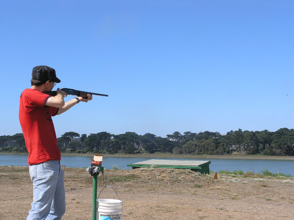
And for over 80 years, the cracking of gunshots was a regular part of the Lake Merced experience, reverberating from the Pacific Rod and Gun Club on the west side of the lake. The club was open to the public for recreational skeet shooting until it closed in April of 2015. The 11 acres of land underwent a major cleanup as a result of contamination from lead pellets used prior to 1994, when they were banned. The site, now known as Lake Merced West, is ready for a new tenant, and Rec & Park is currently considering proposals that provide public access and maintain water quality and watershed health.
The lake is part of the city's Natural Areas Program, and Rec & Park works to preserve and enhance park resources. You can get involved in volunteer work days to participate in pruning, invasive vegetation removal and native species planting.
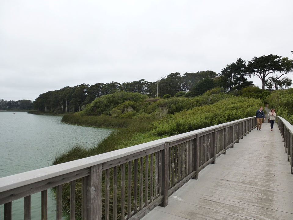
Another popular lake access point is the Sunset Circle parking area. A statue of Juan Bautista de Anza greets visitors to the north side of the park where Sunset and Lake Merced boulevards meet, a reminder that the historic exploratory mission passed near Lake Merced in the 1770s. The 29-Sunset bus stops here and there is ample parking. From here, ramps lead down to the lake where North Lake and East Lake are spanned by a wooden footbridge that connects to Harding Park golf course. To the east of the bridge near Middlefield Drive is an upland natural area known as the Mesa that includes an off-leash dog play area.
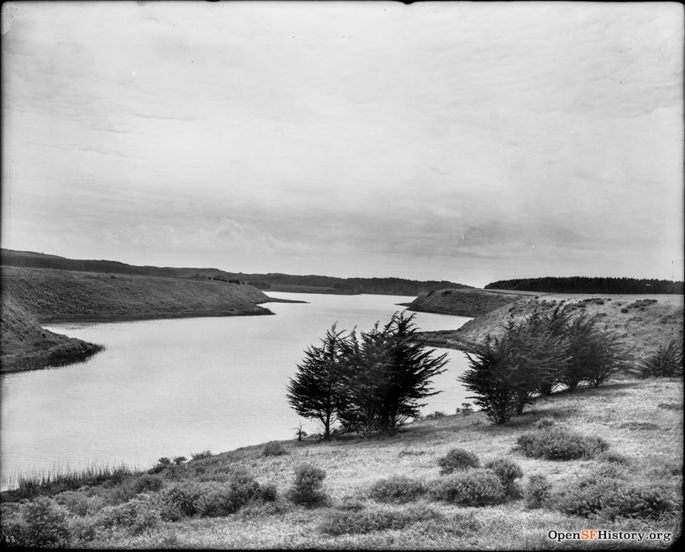
Near the Mesa, two photos taken from the same location over 100 years apart illustrate the changing landscape around the lake.
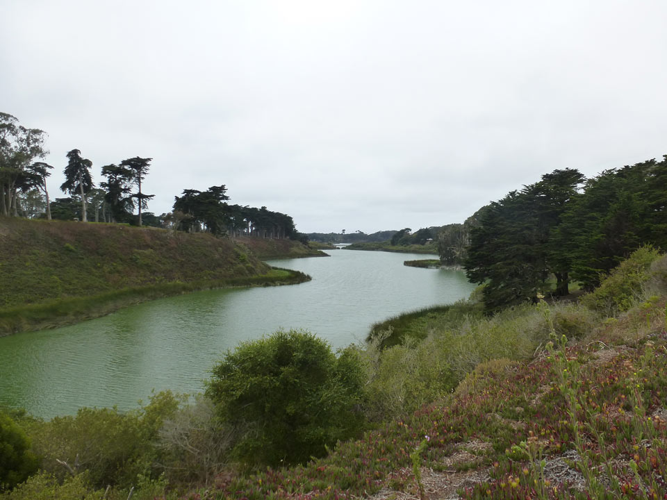
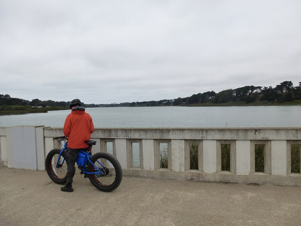
Moving south, accessed near Brotherhood Way on the east side and along John Muir Drive on the west, the Lake Merced concrete bridge separates South Lake and Impound Lake. This division was created in the 1950s as sediment built up around a culvert that spanned the lake. The concrete bridge allows for bicycle and pedestrian access to both sides of the lake, where there are parking lots and picnic tables.
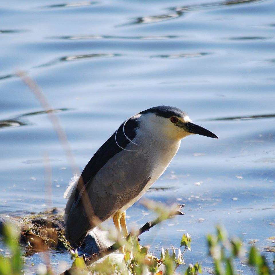
Birds are abundant here. Dominik Mosur, an avid San Francisco birder, recently spotted over 12 species of birds at dusk in an eight-minute period from the concrete bridge, including over 30 ducks, two common yellowthroats (a species of special concern), two black-crowned night herons, and a Western Grebe.
For history buffs, a short diversion from the lake takes you to the site of California's most famous duel just across the border into San Mateo County. Near the intersection of El Portal Way and Lakeview Drive, a small park and a state historic plaque marks the spot where David C. Broderick, a U.S. Senator from California, and David S. Terry, a former chief justice of the California Supreme Court, attempted to settle their differences in 1859.
If you’re interested in exploring Lake Merced, Rec & Park hosts a monthly guided Healthy Parks Healthy People walk around the lake on second Saturdays at 10am. The next hike is on September 10 and starts in front of the Lake Merced Boathouse.
Getting there: The primary access points at Lake Merced Park are: Skyline Boulvard and Harding Road, Lake Merced Boulevard and Sunset boulevards, Lake Merced and Brotherhood Way, and John Muir Drive at the concrete bridge. Parking lots are located at these access points and street parking is also available. Several Muni bus lines serve the park, including the 57-Parkmerced, 29-Sunset and 18-46th Avenue. Most of the park i wheelchair accessible.


